

SATELLITE IMAGE PROCESSING TECHNIQUES
ఉత్పత్తి వివరణ
SATELLITE IMAGE PROCESSING TECHNIQUES
Remote Sensing Satellite Image Processing Features
1
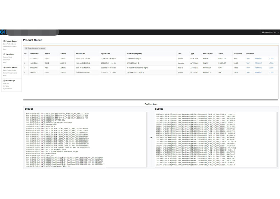
Image processing system is the core of satellite image preprocessing after landing.
2
The system decrypts and decompresses the received original code stream data, completes the analysis and processing of auxiliary data, and then catalogues the data.
changguang Jilin 1 satellite constellation is the core project under construction by CGSTL. The first phase of the project consists of 138 high-performance optical remote sensing satellites covering video, high resolution, wide band, infrared, multispectral and other series. At present, CGSTL has sent 73 Jilin-1 satellite constellation networking remote sensing satellites into the designated orbit through 19 launches (of which, SP04 has been retired on August 31, 2022). Up to now, Jilin-1 satellite constellation has 72 in orbit remote sensing satellites, and has built the world's largest sub meter commercial remote sensing satellite constellation.